Row, Row, Row Your Boat Gently Down the Stream …
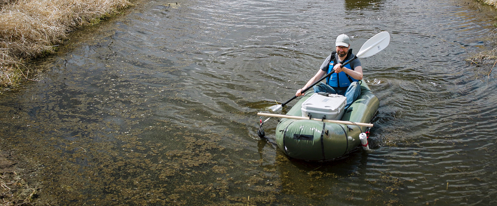
"Thinking outside the box" can lead to innovative solutions. It certainly worked for ARS scientists in St. Paul, MN, who needed a better way to monitor water quality in streams and drainage ditches near farm fields. Taking samples at one point from the water’s edge is the traditional approach, but what if you need more detailed spatial data? Why, pull out your handy inflatable raft, of course—and "retrofit" it with a GPS unit, data logger, and optical sensor platform. The scientists did just that as part of a watershed-scale effort to track the escape of nitrate.
A surplus form of nitrogen fertilizer, nitrate losses from midwestern farm fields into the northern Gulf of Mexico via the Mississippi River basin can trigger "dead zones" that deprive fish and other aquatic life of oxygen. By gaining access to hard-to-reach drainage ditches and streams, raft-bound scientists can measure and map nitrate continuously as they paddle. The resulting analysis can then help design new nitrate management strategies, like strategically locating woodchip-filled beds called bioreactors in fields to remove nitrate from drainage water before it reaches nearby streams.
Related Information
Publication: A Novel Approach for Determining the Effectiveness of Conservation Practices in Reducing Nitrate Losses


